
Welcome to Pettyjohn Cave Discussions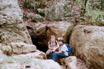

Posted on September 26, 2011 by Hubert
Welcome to the Pettyjohn Cave discussions. I would love to hear about your trips into the cave, were you visited and what you found. I have been caving in Pettyjohn from the 1970′s and have not seen all of the cave. If you have any pictures that you would like shown on the Virtual Tour please e-mail me a copy and tell me were they were taken in the cave. I plan to start taking 360 deg pictures of the main rooms for the tour. If you find one of the registers in the Virtual Tour, please sign the Guestbook so others can see who has been there.

September 26, 2011 at 8:19 pm
Amy (mac_amy2005@yahoo.com)
Wed 05 Jul 2006 10:09:25 AM EDT
I have only been three times and it’s been so much fun…this past monday I was there (3 july 06) and there were two large groups of cavers. one from a church in Florida, and the other a boy scout troop from north GA. one or both of the groups completely trashed the place inside and out. There was trash from outside the entrance all the way beyond the pancake squeeze. when my brother and I were exiting the cave, someone had freshly urinated on the “slide” and we had no choice but to climb up through it. I have been an outdoors person all 31 years that I’ve been alive, and I know how to clean up after myself and not leave it for someone else to do. I am from Gwinnett county GA, and it’s about a 2.5 to 3 hour drive to get to Pigeon mountain. So to drive that far and have to deal with groups of people that have no respect for the outdoors is painfully disturbing. Other than that I’ve enjoyed my caving experience and would like to continue finding new and exciting routes inside Pettijohn Cave. Are there anymore caves nearby that are about the same level of difficulty as Pettijohn? I have heard of Hurricane Cave…do you know where I can find a map of Hurricane cave?
LikeLike
Jon (jonmccutchen@yahoo.com)
Fri 30 Jun 2006 03:14:14 PM EDT
I love this cave! And so far we have oodles of pictures. I’d love to pick out some with identifiable landmarks and send them to you if you’re interested (I’ll need to know how). We have not been too far in the cave (only 2 trips so far) – I believe the pancake squeeze area is where we stopped – we were uncertain which was the proper route through that area. The arrows seemed to indicate something different than was on the map. (?) Regardless, we are going again this weekend – our 3rd trip in as many weeks. We will try one – if not both – routes from the squeeze. We hope to explore much beyond that – as well as other routes off the main hall. As always, we’ll have a camera full when we return and I’ll get back here to show you. I hope to run into you up there one day.
LikeLike
September 26, 2011 at 8:22 pm
Lance Dofflemyer (lancedofflemyer@hotmail.com)
Fri 24 Feb 2006 10:47:42 AM EST
Some friends and I have been visiting Pettijohns cave almost every weekend for a while now. Its almost impossible not to go back! We enjoy very much the hand work of God and seeing what He has created. If we could ever meet up we would be more than happy to buy you lunch! Any advice for caves and other caves in Georgia would be greatly appreciated. Thanks!
LikeLike
Exploring Pettyjohn Cave Tour now links to Google Street views
Posted on June 20, 2010 by Hubert
After loading a new panorama of the entrance room, I thought I would try and link to the parking lot and Google’s street views.
From the cave entrance pan left and click on “Trail to parking and checkin.” Move the pointer below the notice board on the left and click on the arrow “To the parking lot,” that will appear. Aview from the parking lot toward the checkin board will appear.
You are now on Google Street View with all kinds of things to do. As you move the pointer around you will see squares for Zooming or positions. The road name will also appear “Rocky Ln,” along a line parallel to the road. Hold down the left mouse button to pan around and up and down. The parking lot is the area with the large boulders and the cars belong to cavers in the cave at the time the pictures were taken.
Right click will bring up a short menu of options. check out the 3D mode! Click on the square in the upper right for a full screen view. Press “Esc” to return.
Click on the lower right corner for a street map. Click on the upper left corner of the map to enlarge to split screen.
If you want to get out of the frame and explore with google, click on “Explore Cave” this will remove the menu’s. Follow the trail back to the parking lot and this time you will be in a new Explored window. Click on “View Larger Map.”
To get started:
Explore Pettyjohn Cave on line
LikeLike
Pettyjohn now on Facebook
Posted on August 14, 2011 by Hubert
Pettyjohn Cave now has a Facebook Group, please feel free to join us and share your pictures and trip experiences.
https://www.facebook.com/groups/362256723821/
LikeLike
How do I read the maps?
Maria (m42203@bellsouth.net)
Wed 09 Sep 2009 12:12:00 AM EDT
My husband and I have explored the beginning of Pettyjohn Cave a few times(most times with our three children with us) and we have yet 2 make it to the waterfall, I am not comfortable going further than I am sure I rember unless I can understand the map I am reading and the yellow map available up there dosen’t make sense to me and I have no idea where I am when I look at the map. I don’t know how to recognize places on the maps here either, am I missing something? We have gone back to the rock wall, climbed over it and under a little crawl space to the top of a wall, climbed down the wall, over a bridge type rock then to the left and down into a room that you slide down into, it is a large roundish room with one exit going down(a rope avaiilable there), a small tunnel, and another exit up and over some flat rocks. We went down the side near the rope and then went back as far as the tunnel. The four year old was tired by now so we turned around but my husband and I would like to go back ourselves and find the waterfall, is one of the color arrows a path to it? Thanks for your help. The map is hard to follow and unless you know where the crawls are it is hard to get behond the main room. My suggestion is to go on a Saturday and talk to some of the other people that visit the cave. They may even show you the way to the waterfall. The route to the waterfall is at the lower levels and is wet and muddy. I would also suggest not trying the trip during or after a rain storm. Hubert
LikeLike
Pettyjohn first trips
Hunter Murphy (hunter.murphy@juno.com)
Mon 13 Sep 2010 09:24:30 PM EDT
I just wanted to make a post and talk about my first two trips into Pettyjohn. I have officially been in two caves in my life, once on a very easy tour through Cumberland caverns in Tennessee, and twice into Pettyjohn. My two trips into Pettyjohn have been in the past month, the first with two good friends, and the second with one of the same.
I would like to thank Mr. Crowell for his amazing documentation on the cave, including his virtual tour and fantastic text about how to actually get places in the cave.
My friends and I had heard about the cave, and on a trip to Rock Town, we had heard about the cave and decided to stop by and check out the entrance. After taking a look, we decided to come back the next weekend and do some exploring. None of us are experienced cavers, and all of us who entered the cave were there for the first time, so in the week leading up to the trip, we did as much research as we could and planned a route, and decided what to bring along. We found Mr. Crowell’s website and read his articles on the Pettyjohn loop, and decided to try and make our way through some of it. When we got to the cave, we ended up going to the back of the entrance room and doing the last bit of the loop based on what we had read, and successfully made our way to the back of the Volcano room. Once we got to the window into the Volcano room, we wanted to go down in, but none of us are experienced climbers, and we had no climbing gear, so we decided not to drop from the window. We found the bypass tunnel, but did not exactly remember what Mr. Crowell had written about it, and decided we were not well enough informed to try it. On our next trip, we made our way back to the Volcano room, and went for the squeeze down, having no problems and enjoying the room thoroughly. We even found that the mud man with the hat Mr. Crowell described in his second article about the loop was still there! This was the end of this part of our second trip, as we had been in the cave for about six hours and were exhausted. On the second half of our first trip, we made our way back to the entrance room and climbed up onto the ledge over the entrance to the passage leading to the Pancake squeeze. We did not know that this was the location of that entrance, until, while we were on the ledge admiring the formations, a small group emerged. we had a short conversation, and when we found out that they had just come from the Raccoon room, we decided to go see what we could find.
We ended up finding our way through the pancake squeeze, and down to the room with the drop to stream level and the climb to the Raccoon room. This was the end of our first trip, because we were exhausted from the trip to the Volcano room, which had taken quite a while to complete without a guide. At the beginning of our second trip, before our trek to the Volcano room, we went straight down through the pancake squeeze and into the room with the drop to stream and climb to the Raccoon room. We were interested in getting more familiar with the first leg of the loop, but on our first trip we were not sure of the entrance, and after reading more of Mr. Crowell’s articles, we went back and found the climb to the Raccoon room, but decided not to try it, being inexperienced climbers.
We ended up taking the plunge to the stream and moved upstream toward the main waterfall, moving slowly and cautiously, being unfamiliar with this part of the cave. We managed to work our way upstream to the entrance to the double echo domes, and continued further upstream, but stopped our journey before long. We made it to a fork in the stream, where it continued forward under a very low ceiling, or up left through a very muddy passage. We decided to go up left, because we didn’t want to spend a lot of energy crawling, as we knew we were near the point we would need to turn around to have the energy to make the long climb back up from stream level. We ended up coming into what appeared to be a fair sized room, but did not venture in as it seemed to have the potential to be a confusing room to find the way we came, and so turned around and made our way back, resulting in the second trip to the Volcano room. We have been very careful and slow, being so unexperienced, and brought along plenty of food and water, headlamps, backup flashlights, and extra batteries, trying to prepare for the unforeseen.
We have also made the habit of letting multiple people know where we are, both the cave itself and our intended route through it so that if something does happen, and we do not emerge when we intend to, they can get us help. Gladly, both of our trips have resulted in safe return. We love this cave, and have been planning our next trip. Both trips have ended up being almost exactly seven hours underground, and made possible almost entirely based on Mr. Crowell’s information. We have plans to eventually make our way through the loop, to the main waterfall, and possibly up to the Double Echo Domes and Echo room, once we have improved our climbing skills and are confident in our ability.
We sincerely thank Mr. Crowell for providing the information that has made, and will make, our journeys through this wonderful cave safe and fun.
LikeLike
As so many people go to the waterfall, I thought it would be a good idea to re-post the following trip report.
Original post was on Wed 07 Dec 2005 :
My friend and I got lost in the Pettyjohn Cave last weekend for 24 hours without food or water. Luckily, we found a waterfall and drank the water. Eventually, we heard voices and we yelled for help. They showed us the way out and provided us with food and water. We are very fortunate to have survived this horrible situation, and we will be well prepared in the future if we go caving again. I would like to use your cave mapping software to map out further places in the cave, ones that your cave map did not go to. We got lost in these areas, and ended up at a second, smaller waterfall. We didn’t know our way back from here, because we were even unsure that another waterfall was in Pettyjohns, but we were lucky to have heard the voices the next day.
Dear Mr. Crowell,
I am extremely grateful that we are able to tell you this story today. I am honored that you are going to post it on the forums. Do you think you could send me the internet address of the forums you will be posting it on? I was also wondering if there is any way to get in touch with the Dogwood City Grotto, specifically the members Pete and Chuck. They saved our lives. I hope you enjoy reading about the experience.
We entered Pettyjohns cave at 3pm Saturday, with headlamps, a bottle of water each, and no food. We were not planning on being long, only about 2 hours or so, and we had been in the cave before. We were trying to go to the main waterfall, the one where most people go to. We had been down there before, and we thought we knew the way.
We progressed down the stream tunnel towards the main waterfall. We made it to the waterfall, and that’s where we ran into trouble. We had to find our way back. We were pretty familiar with this area though, so it wasn’t that bad. We took the Z-Bend, which I had never taken, but my friend had. He said that it’s another way to get to the waterfall. After that, we got lost.
We kept trying to follow the arrows, thinking that they would lead to the entrance. The arrows kept changing colors and directions, though, making them almost impossible to figure out. We would go into a large room, trying to find the way we came from, find a passage, follow it, and then about 30 minutes later end up in the same exact cavern. We kept running across places we had been before multiple times. We found a spray painted part saying “Don’t smoke weed in the cave” and we also saw “US Soldier” spray painted on the wall, I believe.
I’m going to try to describe the part we got lost in, in as much detail as I can.
We ended up in a huge cavern where there were MANY ways to go. There was a very small hole that didn’t even look like a passage at all. It was shaped like a triangle, and you had to squeeze to get in it. Once you got in, in front of you was a white arrow and a circle, pointing down. There was a way to go on the right, a way on the left, and the previously mentioned white arrow. There was also an orange arrow pointing a different way. After following the white arrow, we had to get on our hands and knees and crawl for about 3 minutes. We ended up in a huge room with 3 huge formations. There were large obstacles you had to go over, and a cliff on the other side. On one side, there was about a 10 foot drop into a small creek passage. I fell into this by accident. A little bit down the creek, there was a huge rope, about 40 feet high. Downstream from that was a small waterfall with a rope next to it and ways to go up there. By this time, we were exhausted, dehydrated, and thirsty. We started drinking the water from the waterfall to get hydration and energy.
Now we had to find our way out. We couldn’t stray from the waterfall too much, because it was our “safe place” where we could get hydration. We didn’t want to get going in the wrong direction, either, because the cave is over 7 miles long. That’s only the explored passageways, though. We kept following passages that we thought we took and we kept ending up in the same couple of spots. We kept coming up to a place where it looked like a pancake squeeze all around, but there was NOWHERE to go. We went back to that nasty mud area…the “bigger, muddier” pancake squeeze. It took us 3-5 minutes of crawling on our hands and knees just to get through the damn thing. It was extremely muddy, too. We kept going until we reached the dreaded “white arrow room”. We kept ending up in that one big cavern, where there was nowhere to go. We kept trying to find passageways to go up, because we were trying to get to the ground level, and we really didn’t want to go farther into the cave.
We kept staying close to the waterfall, because we figured if anyone comes down here, they’d probably end up at the waterfall. We had to keep moving, though, to keep our blood flowing. It was freezing cold, and the roof was “raining” on us. Apparently it was raining pretty badly outside the cave. We kept wandering and wandering, making sure we weren’t staying too far from the waterfall, so we wouldn’t get even more lost.
We slept near the waterfall, and when I turned off my headlight, I saw lots of hallucinations and images. It was really crazy, and I guess that’s what happens when you’ve been staring at the light for over 20 hours.
Sometime the next morning, when we had been wandering, crawling, climbing, and looking for the exit, we heard voices. At first, we thought we were hallucinating, but then we both started yelling as loud as we could. The voices got closer, and we eventually saw a light. We were so relieved and happy to be alive.
Apparently, we had made our way onto a huge cliff and we were on the wrong side of it. We were about a football field away from the other side. To get to the other side, we had to crawl halfway on a ledge as wide as a coffee table. We were about 40-60 feet up, and we had to cross this area on a small bridge about the same width. Once we got to the other side, we crawled on our hands and knees over to the muddy, steep hill on the side of the cliff. There was a rope on the other side, and we had to make our way down that muddy hill diagonally, making sure not to lose our balance or our foothold. Once we made it to the rope, we had to descend about 40 feet to the ground.
Once on the ground, we introduced ourselves and told them about our situation. There was a good group of cavers, from the Dogwood City Grotto. The two leading the group, Chuck, and Pete (I believe) were the most helpful. After that long of a journey, they helped us find our way back to the pancake squeeze and into the main entrance room. They made sure we were alright after we got out of the cave. We really owe our appreciation and thanks to those two members of the Dogwood City Grotto. Without them or their love of caves, we would not have found our way out, and we would have been another accident statistic on the charts. We are extremely fortunate for their help, and we can’t even put into words how much gratitude, appreciation, and respect we have for those people.
We owe our lives to them.
Sincerely,
Ryan Garrett
LikeLike